
Helpston is the birthplace of John Clare, known as the Northamptonshire peasant poet. In his lifetime the village was in the Soke of Peterborough, part of the County of Northamptonshire. Now it is in Cambridgeshire. There is masses of info and photographs of the villageon this site.

Ready to go - outside the John Clare Cottage in Helpston, now a museum with a café.
Almost opposite the John Clare Museum, the path leads east out of the village, and alongside a field before turning right (south) along the hedge. We followed the field boundary, through a gap in the hedge and to the left before crossing a ploughed field ( dry, luckily) diagonally to the left, emerging at College Cottage. We walked almost due south again before turning quite sharply to the right (west). We followed the field boundary again, almost parallel to a line of pylons. When we met the Torpel Way we turned left and made for the edge of some woodland. We walked along by the wood until we reached a road (Stamford Road). Instead of walking along the road, we turned left towards more woodland, then slightly to the right towards the road again.

Unfortunately the sweetest juiciest blackberries come with the scratchiest sharpest thorns.
At the road we turned left and very soon took the path to the right. You don't go through the trees which are ahead, but turn right and follow the wide grassy track through the fields. It skirts another wooded area, then goes gently uphill to the Stamford Road again.
We had a snack break here, then walked along the road as far as the farm shop (not open on Mondays), before turning right.
The path goes past an area which has been landfill - lots of meters for measuring methane. There is also a Nature reserve at Swaddywell Pit. (Swordy Well in a John Clare poem).

The former quarry and landfill site has had the topsoil replaced, and is now rich in limestone wildflowers such as bee orchid and wild carrot. There are many butterflies, and moths, as well as skylarks and buzzards.
 |
| A blowy day We walked along the left hand side of another wooded area and then came to part of Heath Road. There is a Roman villa underground  though we saw no evidence of it. We reached a track turning right from the road, just before Rice Wood, and followed it, then turned left to walk with Rice Wood on our right. |
The path comes out in Helpston, and we made our way past the Almshouses

to West Street with its memorial to John Clare and the Butter Cross. [Butter Crossat Helpston was where a weekly market took place. Customers had the added protection of knowing that traders were selling their wares by the Cross.This meant that everything was above board and the integrity of those traderswas guaranteed. Who would dare sell dodgy goods under the protection of the Almighty? Info from Peter Hill, via Barry - many thanks! ]

then had a look round St Botolph's church with its octagonal tower

before going into the café next to John Clare's cottage.


 I forget the name of this creek but it was only a few miles into the park and it was the first view I had of Mt Rainier. Breathtaking.
 This is a little further into the park. When the roads were constructed through the park the engineers took into account the “viewing pleasure” of the public and I must say they did an excellent job in selecting the sites for the viewpoints.
 A couple of close-ups of the top of the mountain.
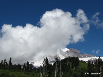 Probably the most visited area of the park is in the south-central part. It was about 12:30 in the afternoon when I arrived in Paradise and, as you can see, the clouds had moved in. I spent some time in the visitors center at Paradise - looked at the exhibits, viewed the park movie, then looked through the telescopes and saw three climbers halfway up the mountain.
 The mountain played peek-a-boo with the clouds, but they eventually completely blocked out the view. I joined some of the other visitors on a short walk along one of the many trails in the area.
 Mount Rainier and me!


