Wednesday, July 31, 2013

Jurassic Way 9 - Fineshade to Gretton

With Marta - 11 miles. Started fine, until we reached the road near Harringworth Lodge, then buckets of wet stuff.


We began by thinking we'd not do a decent walk today - forecast wasn't good. So we took one car to Fineshade and started the activity with a cup of coffee. Kick-start caffeine style.

It felt warm and there was no rain, so we decided we'd start off doing this leg in the reverse direction from the rest of our walks, with the proviso that we could retrace our steps if conditions didn't seem good.


From the car park we took the road downhill past the main block of buildings and over the bridge. There was a footpath sign leading us over the field - downhill at first, then up into the woods. Lots of pink poppies were blooming here. A right turn through the strip of woodland, until the path emerges into a field and then an enclosed path above Fineshade Abbey. As ever their flock of Jacob's sheep were grazing.


Downhill to the footbridge and across the final field to the A43. Across the road and along the path to Laxton Hall, turning right at the second gate, crossing a field, climbing a stile, crossing another field and entering Wakerley Woods. Here the path goes more or less north-west, though there are a couple of kinks and the Jurassic Way signs are not always obvious. It's as well I know this part of the route by now. The path joins a wider track which takes you to the main entrance to Wakerley Woods from the road.


I went wrong on the next bit - I decided to follow the way-marker instead of walking a short distance along the road. However once we'd set ourselves right we followed the road for a short distance and then took the path through the hedge - quite overgrown this year and round a field behind Wakerley Church. We saw masses of wildflowers - from tiny violas and speedwell to scabious and white campion.


The path comes out next to Exeter House - the old pub, now a private residence. Here we turned left and walked along the road past the junction to Barrowden, until we reached a sign post for Jurassic Way to Barrowden on the right hand side.


The path goes down to the Welland, crosses over a footbridge and climbs slightly to Barrowden emerging near the old mill and mill-pond.


We called in at the Community Shop for a sandwich and soft drink, then walked through the village, past the pub and duck pond, to where the road divides. We took the left hand fork, then turned left to a footpath over a stile and across a field to our right.


The path was clear and easy to follow downhill and along to the south west. After a few fields we arrived at a wider track. We turned left along this to cross the Welland at Turtle Bridge.


The Welland looks full at Turtle Bridge


We had expected it to be very soggy near the river, but it was nowhere near as bad as we anticipated. The path turns right and follows the river along the edge of two large fields, before heading south across the third field. Once again the path was clear to see and easy to walk. We met the road between Harringworth and Wakerley, crossed over and walked through Shotley - really just a few houses and a farm, where building work was in progress.

The footpath has been diverted - an improvement, especially while the work is being done.


We climbed part way up the hill, and took a break just before a hedge. Well-timed, as five minutes after we set off the heavens opened big-time. I haven't been quite so wet for a year or so.


The path emerges on to the road between Harringworth and Laxton, and we picked it up again slightly to our right. Once again it was clearly marked and took us over a couple of fields to Harringworth Lodge. You skirt this house by turning left just before the tennis court, then right to join the drive past the house and the fox weathervane, down to the end of the lake. Turn right again along the side of the lake and follow the Jurassic Way signs until you reach Gretton.


Saturday, July 27, 2013

My new boat!


Well, after 10 years of wanting a kayak I was finally able to get one! I went down to Duluth this week and picked up a Wilderness Systems Tsunami 165. I could barely contain my excitement as I drove back from Duluth with the kayak on top of the car. This evening I went for my first paddle in the new boat.


It was a sublime evening on the bay, perfect for trying out the boat and getting a feel for it. I was just going to goof around right in front of the house with it, but it was so nice I decided to actually "circumnavigate" the bay with it. The first thing I noticed was how much easier it glides through the water compared to my canoe. I played around for a little while in front of the house, practicing turning and getting used to the feel and balance of the boat. Then I headed over to the Hat Point Marina and paddled up to the Isle Royale ferry "Wenonah", which looks positively gargantuan from the seat of a kayak! Next, I headed for Pete's Island. After only about 10 minutes of paddling, I was at the island (I thought it would take longer to get there!). I landed and got out for a minute to stretch my legs (not used to the sitting position yet!).


For the next leg of my "trial paddle", I went from Pete's Island to "The Pines", a picnic area on the east side of Grand Portage National Monument. As I crossed the bay there was a gentle swell rolling into the bay and every now and then one of the swells would give me a little push, causing my speed to increase. As the boat rose and fell on the backs of these swells, it was a wonderful feeling. It felt like I could feel the lake breathing. I can tell I'm going to love this sport! This wasn't my first time kayaking, but it had been awhile so the sensations all felt new again. After reaching the pines, I turned and followed the shoreline back to my house. This part of the bay is very shallow and almost entirely sand bottom. It was fun gliding along and watching the ripples in the sand as they passed beneath the boat. When I got back to my place, my brother was sitting there waiting for me. He had seen me paddling and wanted to give the boat a quick try. I pulled up parallel to shore and in my haste to climb out, promptly tipped over on the lakeside of the boat and got completely wet. Oh, well! I also got to try out my new bilge pump :-) I can't wait until the next outing!

Friday, July 26, 2013

Greetings from New York :: Thanks, Apple!

Yes, I'm still here. Or somewhere! I haven't been posting as much as I would like to – it's a lot harder than I thought it would be to find the time (or just take the time) to write while traveling.

I'm in New York, southeast of Snowville, after spending last night and this morning with Apple and her husband. We had a great visit - it was so nice to be able to meet her in person. And I certainly appreciated their warm hospitality. Thanks so much Apple, for putting me up for the night.


More later on the meandering route taken through Ohio on the way to New York... soon, I promise!

Wednesday, July 24, 2013

Blizzard Report, from Somerville MA

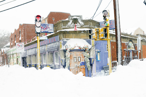
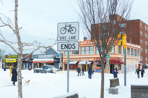
Blizzard, Beacon St, Somerville MA

As you may have heard, we've had a little snow here in the Northeast. We were out of town in the days before it was expected to hit, and hurried to make it back before the travel ban went into effect. Yes: a motor vehicle travel ban for all of Massachusetts was declared, with violations punishable with a year of jail time. Still, here in Greater Boston many doubted the seriousness of the blizzard to come. We've been fooled before with promises of sensational snowstorms, only to receive a measly couple of inches.


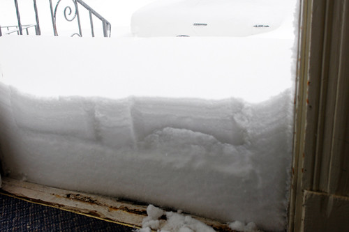
Blizzard Front Door, Saturday AM

This time however, the universe followed through. Over 2 feet of snow had piled up outside our front door by morning, and that was after the stairs had been shoveled the night before.


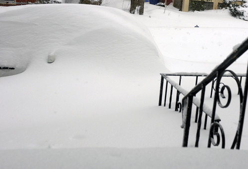
Blizzard Front Door, Saturday AM

Beyond the front door I could see an awkward heap of snow, which I realised was the neighbours' car.


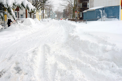
Blizzard, Beacon St, Somerville MA

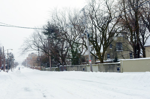
Our street looked like this, after the plows had gone through it.


Blizzard, Beacon St, Somerville MA

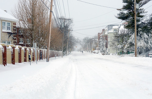
The normally busy main road looked like this.


Blizzard, Beacon St, Somerville MA

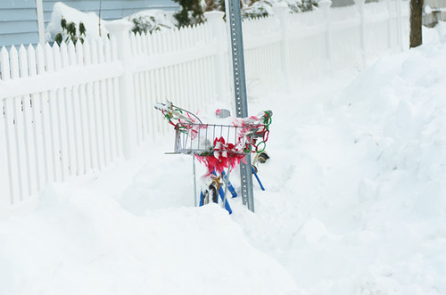
And this. (Notice anything missing?)


Blizzard, Beacon St, Somerville MA

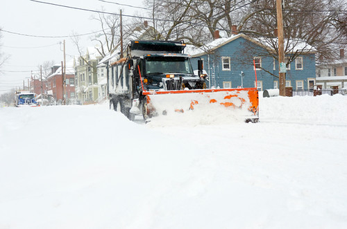
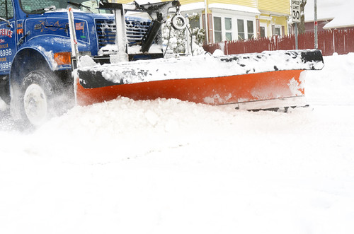
At around 9:30am I saw a procession of plows making their way down the road.


Blizzard, Beacon St, Somerville MA

But it continued to snow until mid-morning, quickly covering any progress the plows made with another dusting.


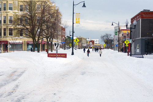
Blizzard, Union Sq, Somerville MA

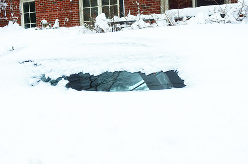
I encountered surreal scenes, such as this one. Any car that had been left out on the street had now turned into a giant snowbank.


Blizzard, Union Sq, Somerville MA

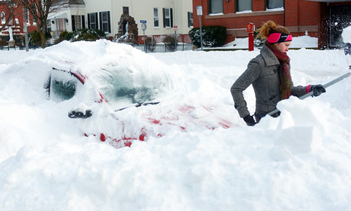
Once the snow stopped falling, vehicle excavations began.


Blizzard, Union Sq, Somerville MA

They would continue zealously until sunset.


Blizzard, Union Sq, Somerville MA

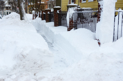
Clearing sidewalks was tricky, considering how much snow had fallen. Some dug trenches, which had to be navigated single file - the snow nearly waist-high.


Blizzard, Union Sq, Somerville MA

But for the most part the sidewalks had not been cleared and pedestrians took to the roads.


Blizzard, Union Sq, Somerville MA

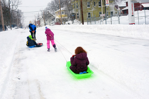
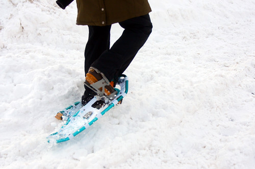
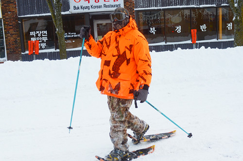
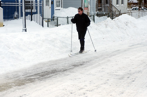
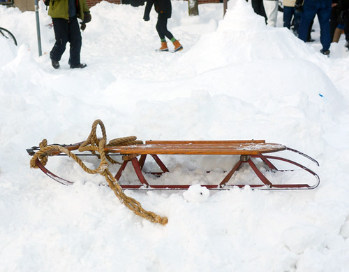
Mostly on foot, by sometimes on sleds, snowshoes, and skis.


Blizzard, Union Sq, Somerville MA

I was a little envious of the snowshoes I have to admit; I would love to try them.


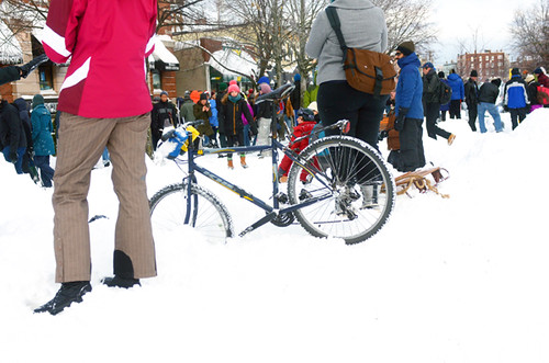
Blizzard, Union Sq, Somerville MA

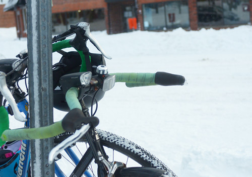
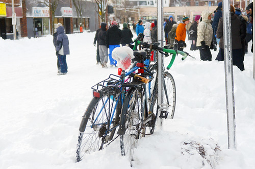
In the first half of the day, I did not see any bikes being ridden. The road surface was too uneven and soft for most cyclists and bicycles, myself included.


Blizzard, Beacon St, Somerville MA

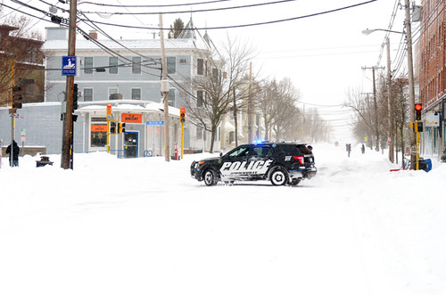
At least in the first half of the day, the driving ban was enforced. A police SUV slowly circulated the neighbourhood shouting threats over the loudspeaker at anyone who attempted to drive, other than snow plow operators and city workers.


Blizzard, Union Sq, Somerville MA


Pedestrian movement was not impeded, and soon people took over the roads.


Blizzard, Union Sq, Somerville MA


At some point, word came that a party was being held in nearby Union Square.


Union Square Snow Day, Somerville MA


Pretty soon, it seemed like the entire neihgbourhood headed that way (except those still digging out their cars!).


Union Square Snow Day, Somerville MA

There was music blaring and people dancing. Despite the potentially serious nature of a blizzard of this magnitude, the atmosphere in the entire neighbourhood was downright festive. Those out on the streets were saying hello to one another, and smiling ear to ear.


Union Square Snow Day, Somerville MA

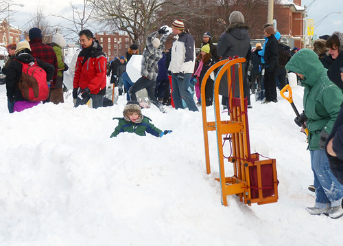
Kids, adults, everyone looked happy to be outdoors, enjoying themselves.


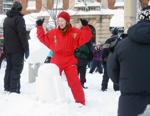
Union Square Snow Day, Somerville MA

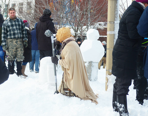
Some wore costumes.


Union Square Snow Day, Somerville MA

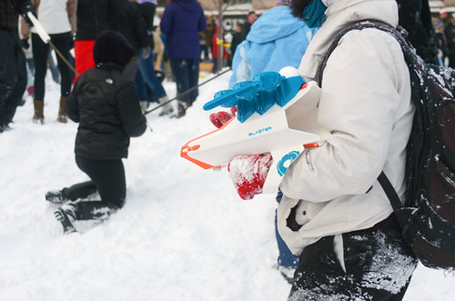
Others came ready to fight.


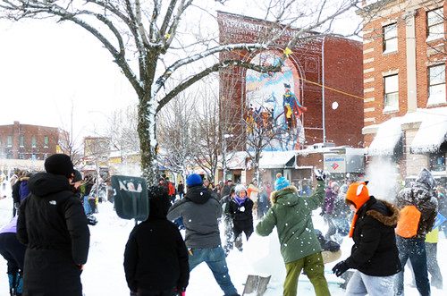
Union Square Snow Day, Somerville MA
Which they did, to the sounds of dance music, with the Somerville Gateway mural as proud backdrop.


Blizzard, Union Sq, Somerville MA

As the afternoon waned and the snowplows laboured tirelessly, I began to see a few bikes here and there.


Union Square Snow Day, Somerville MA

But still mostly sleds.


Blizzard, Union Sq, Somerville MA

Andtoboggans.


Blizzard, Union Sq, Somerville MA

And skis.


Blizzard, Union Sq, Somerville MA

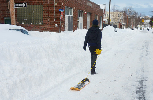
And various snowboard-like contraptions.


Blizzard, Union Sq, Somerville MA

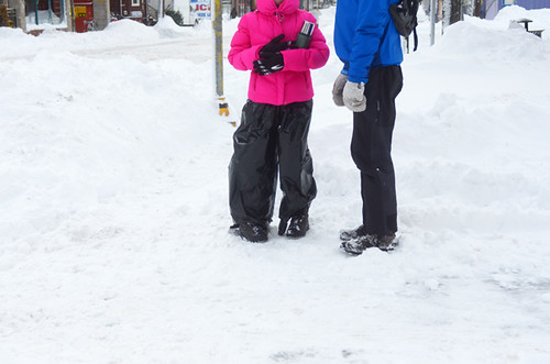
I did a lot of walking throughout the day. Many layers were donned to deal with the cold, but nothing out of the ordinary.


Blizzard, Union Sq, Somerville MA

Others got creative with plastic bags, various DIY overshoes and blanket-capes.


Union Square Snow Day, Somerville MA

To see our entire neighbourhood so active and energetic at a time when it was expected to be immobilised was quite something. By mid-afternoon a few local businesses opened their doors to meet the foot-traffic demand for coffee, alcohol and groceries. All of these places were packed.


Blizzard, Union Sq, Somerville MA

It seems that Somerville, MA has weathered the storm well, and there have been no disasters. In the meantime, the snow plows are still at it. Excavations of vehicles continue. And although the motor vehicle ban is now lifted, along the largely unplowed side streets snowshoes continue to rule the roads.


More pictures here - enjoy the rest of the weekend!

Tuesday, July 23, 2013

If you've got it, flaunt it! COG 55 posted!

And man, the Genea-Bloggers have got it!

Jasia at Creative Gene has posted Carnival of Genealogy, 55th Edition and it is the biggest ever! There are 50 posts by 49 authors covering the "Show and Tell" topic. As Jasia says, "Our esteemed group of contributors is sharing special persons, photos, documents, and heirlooms with you today. You will be truly amazed at the collection of articles presented here! No, I'm not exaggerating. You will be amazed at some of the fascinating items people have shared from their family's history."

My contribution for this edition is Indiana Sisley Stem :: Show and Tell and The Sisley Family Bible. Yes, I submitted two posts, but they are related (pun intended).

The next COG will be hosted by Lori Thornton of Smoky Mountain Family Historian. The topic is "10 essential books in my genealogy library." Check out Lori's post for more information.

Due to the explosive growth of the COG, and the amount of time it takes to put a COG post together, Jasia has a request for all contributors to future carnivals:

Due to the recent rapid growth of the COG, and assuming its popularity continues, I will have to make some changes to the way it is presented. I am asking that all future participants use a descriptive phrase in the title of their articles (i.e. "Miss Kate's Autograph Book" as Denise Olson did) and/or write a brief description/introduction to your articles in the "comment" box of the blogcarnival submission form (i.e. "I loved show and tell in school. Way back then I was only allowed to bring one item. For this edition of the COG I'm bringing a small valise full of items that are all related to A Pink Ball Gown." as Apple did). This will give readers an idea of what you've written about and hopefully interest them in clicking on your link. I will no longer be doing this for the authors. I just can't keep that up with the volume of submissions. I'm also considering other changes to the COG. I'll keep you posted.
The deadline for submissions for COG 56 is September 15th. Use the carnival submission form to submit your post. Past posts and future hosts can be found on the carnival index page.

Carnival of Genealogy graphics created by footnoteMaven.

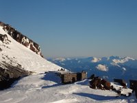
Muir Snowfield and Camp Muir

Muir Snowfield and Camp Muir on May 21 2006

There is great coverage all the way up. Most people are still using the winter trail up to Pan Point. Beyond that the trail is very well wanded all the way to muir. There has been a lot of traffic on it and there is a great boot pack all the way to Muir. Even though it is pretty soft if people stay in the boot track they only end up post-holing in a few places. The skiing on the snowfield is excellent right now. Yesterday we got a dusting of snow and had perfect corn underneath that above 8500'. Today all of that froze and the snow was rock hard down to about 8500', but below that it was a wonderful 3" of soft wet snow on top of a frozen base so it was fun fast skiing. The chute down onto the Nisqually was stellar and fairly easy to traverse back up to the main trails at the glacier vista overlook (we did not have to put our skins back on). There are also two really fun kickers just below glacier vista :)

All in all its in pretty darn good shape for skiing. I would say folks don't need crampons unless they plan to travel really early or really late in the day. Skis or a board will make it lots of fun and I don't think snowshoes are that helpful since the boot pack is so well traveled.


The Camp Muir Public Shelter was significantly refurbished in 2005. The new interior design increases the usable space markedly. The bunks are organized to accommodate more people, as is the storage and cooking space. So far, the comments have been very positive; in particular, many expressed appreciation of the increased lighting.

If you plan to stay in the public shelter, please keep it clean! Always secure the door when leaving, as a small crack will fill the hut with snow during storms. Never leave anything (food, gas, and gear.) Also, overnight travelers should consider brining own shelter in case they’re unable to make it to Camp Muir. At this time, the public shelter and toilet are accessible.

Please do your part to keep the mountain clean. Petrified feces and toilet paper flags strewn along the climbing routes and crusted on rocks near bivi sites are unsightly and unsanitary. Remember that everyone on the mountain melts snow for drinking water. All parties are required to pack their solid human waste off the mountain when not using the toilets at Camp Muir and Camp Schurman. Blue bags are available with climbing permits. Blue bags may be deposited in the large black barrels at Camp Muir or at Paradise. The barrel at Paradise is located in the restroom tunnel next to the men’s room.

Saturday, July 20, 2013

Vanilla Bean Crème Brûlée


Vanilla Bean Crème Brûlée, originally uploaded by ParsecTraveller.

On a whim Friday night, I decided to make crème brûlée, as it is an easy but delicious dessert.

The recipe I used was from Anita Chu's blog Dessert First. I modified it slightly, such as adding more sugar and more vanilla flavoring. I also added Grand Marnier orange liqueur and rose water, as the recipe called for. Overall, the crème brûlée turned out great, with the smooth flavor of vanilla and the floral hint of rose water. The Grand Marnier was hard to discern, however, so I would add more than the recipe calls for. Speaking of the recipe, it's posted below:

Rosebud Crème Brûlée

makes about 6 servings in 4 1/2 ounce ramekins

2 cups heavy cream
1/8 teaspoon vanilla seeds, or 1/2 teaspoon vanilla extract
3 ounces egg yolks (about 4-5 eggs)
2 ounces sugar*
1/4 teaspoon Grand Marnier**
1/2 teaspoon rose water

Preheat the oven to 300 degrees F.

Find a baking pan that will fit all of the ramekins you plan to use. The sides of the pan should be at least as high as the ramekins. Line the bottom of the baking pan with a towel.

Heat the cream and vanilla in a medium saucepan on medium heat until it comes to a boil. Remove from heat and let sit for about 10 minutes for the vanilla to infuse.

Whisk the eggs and sugar together in a bowl.

Slowly pour about a third of the hot cream into the eggs, whisking all the time to prevent the eggs from curdling.

Pour the tempered eggs back into the cream, whisking constantly until combined. Whisk gently to prevent bubbles from forming.

Strain the mixture into a clean bowl.

Add the Grand Marnier and rose water and let the custard cool slightly.

Arrange the ramekins in the baking pan on top of the towel. Using a ladle, carefully, pour the custard into the ramekins, filling just below the rim. Try to fill all of the ramekins to the same height so they will bake evenly.

Carefully pour hot water into the baking pan until it comes up about 2/3 of the way up the sides of the ramekins. Do not let the water get into the pan.

Carefully place the baking pan into the oven and bake for about 45 minutes to an hour until set. I checked at about half an hour and at 45 minutes, but don't open the oven door too often or you'll lose all the heat and the custards will not cook. You can check the progress of the custards by sticking a paring knife into the custard slightly away from the center. If it comes out covered in liquidy custard, it's not done yet. Also, if you lightly touch the center of the custard and your fingertip comes away covered in custard it is also not done.

When the custards are done, they should shimmy slightly when you move the pan (careful not to spill water!) but the center should not move separately. If, however, it has set like Jello and there are bubbles forming on the top it is becoming overcooked and you should remove the custards immediately. If the custards start rising at any point they have become overcooked.

After you remove the baking pan from the oven and the ramekins have cooled enough to handle, remove the ramekins, cover them, and chill in the refrigerator for at least 4 hours before serving.

When you are ready to serve the crème brûlées, take one ramekin at a time and sprinkle the top with sugar evenly over the top. Using a hand-held blowtorch, carefully caramelize the sugar. Keep the flame at least 2 inches from the sugar to prevent burning the sugar. You can also caramelize the sugar under a broiler.

Let the sugar cool for a couple of minutes before serving. Do not brûlée the custards more than 20 minutes before serving or the sugar may melt.

Recipe courtesy of Anita Chu at http://dessertfirst.typepad.com/dessert_first/2007/04/rosebud_creme_b.html.

*I used more sugar (1/2 cup total instead of about 1/4 cup total).
**You may want to use more Grand Marnier if you want a more noticeable orange flavor.

Friday, July 19, 2013

Millbrook: Westward Ha! (5.7) & Cruise Control (5.9)


(Photo: Just above the final crux of Cruise Control (5.9). Photo by Christian Fracchia.)


Millbrook is a cliff with a fearsome reputation.


Unlike the other large cliffs at the Gunks, Millbrook has no easy access. A hike of at least three miles is required to approach the cliff. Once there, you have to rap in from above to get to the climbs. All of the climbs start from a narrow, sloping shelf popularly known as the "Death Ledge." Above this Death Ledge is a rotten band of rock; many of the climbing routes negotiate crumbly, loose territory for the first thirty to forty feet. And even if you survive the rotten band, you aren't out of the woods. The climbs at Millbrook are steep, difficult, and often poorly protected. 5.11 X is a common rating at Millbrook.


This is a serious cliff. You need to have a good idea of your limits before you go there. When you climb at Millbrook, you will likely be climbing alone. If something goes wrong, help is going to be hard to come by.


Does this sound like fun to you?


And yet the cliff has very attractive qualities as well. For starters, it is the highest, whitest, most impressive cliff at the Gunks. You might not notice it so much from New Paltz but if you spend any time in the area to the south, in Gardiner, for example, you can't help but feel its presence. We've rented a house on Bruynswick Road, which parallels the ridge, and every time I've driven down to this house from the north, following the road past all the major cliffs, I've been struck by how Millbrook looms over the area in the most appealing and inviting way. It is a beautiful, solemn place.


And there are great climbs at Millbrook. Not just hard man test-pieces (of which there are many), but also great moderates (or so I've been told). The introductory Millbrook route, right at the center of the cliff (next to the rappel tree), is Westward Ha!, a climb some consider to be the best 5.7 in the Gunks. Just to the right of Westward Ha! is a classic 5.9 called Cruise Control. Another reputed classic 5.9, Realm of the Fifth Class Climber, is down at the southern end of the cliff. And there are more, a handful of 5.7 to 5.9 climbs that I hear are well-protected and well worth doing, along with several world-class 5.10's and 5.11's that have reasonable pro.


Above all, Millbrook offers solitude, mystery, and the unknown, things which are in short supply at the other major cliffs at the Gunks. Millbrook provides a chance to get away from the same crowded routes you did yesterday and to step into what feels like a real alpine adventure.


Until this past weekend I'd never been climbing at Millbrook. I've been really wanting to go lately, intrigued by Christian Fracchia's website The White Cliff, which has wonderfully detailed topo photos of the whole cliff, along with updated route information that is more precise than what you'll find in any of the official guidebooks. I contacted Chris when I started thinking about climbing at Millbrook, and he gave me great advice about potential routes to climb and how best to reach them.


This past Sunday seemed like a good day to go. Clear skies and cool temperatures made for perfect conditions for hiking out to the cliff. Gail was willing to troop out there with me. I hoped we could knock off the two most obvious candidates, Westward Ha! (5.7) and Cruise Control (5.9), and still have time to maybe hit another moderate like The High Traverse (5.8 with the variation finish) or Realm of the Fifth Class Climber (5.9), mentioned above.


(Photo: On the trail to Millbrook, with Skytop visible in the distance.)


Dick Williams suggests in his guidebook that the hike out to Millbrook will take about an hour. For us the trip was uneventful but it took longer than that. We were slowed a bit by a lot of wetness on the trail, which I guess was a remnant of some heavy rain that fell a few nights before. The hike is perfectly pleasant, and I bet it is quite beautiful in late May/early June when the mountain laurel is in bloom.


(Photo: The rap tree is dead, Fred! What do we do now?)


Once we dead-ended into the Millbrook Mountain Trail and followed it to the cliff's edge, we had no trouble winding our way down to find the traditional rappel tree atop Westward Ha! Unfortunately, however, this tree is 100 percent deceased, as in dead, i.e. finished. This was a shock to us because everyone apparently still uses the dead tree! I don't know how long it has been this way but man, it is over and has been for a while. The tree is a black hulk. We briefly considered using it anyway, since it is such a huge tree, and it is unlikely to fail under body weight for quite a while. But it gave me the willies. I did not feel good about the idea of using it.


Looking around, we saw other rappel options, so it was easy for us not to use the dead tree. We found two trees that were decent-sized and very much alive, about 30 or 40 feet left (south) of the Westward Ha! rappel. These trees are also maybe 20 or 30 feet higher than the dead tree, but I was confident my 60 meter rope would still reach the Death Ledge, since I knew the rap from the dead tree was only 150-160 feet to the ledge.


(Photo: Rapping over the steepness that is Millbrook.)


I leaned out over the lip from our improvised rappel station to check the rap; it appeared to be a sheer drop to the ledge. It did not seem that there were any obstacles and I was more or less certain that the rope would reach. I also felt entirely sure that we would have no trouble climbing a 5.7 route to get off of the cliff. We would not be trapped down there. Still, I felt very nervous. It took a leap of faith to back my ass off the cliff and descend into the unknown. But this whole adventure was my idea, so I had to be the first one to go. I set up my rappel and off I went.


(Photo: The obvious corner of Westward Ha! (5.7).)


Once we both got down without incident, it was very easy to find the prominent corner ascended by Westward Ha! (5.7). And although the Death Ledge wasn't huge, the shelf was flat and wide enough at this part of the cliff for us to move around without fear that we were about to slip off of it and tumble to the talus some 70 or 80 feet below. (Nevertheless we stayed anchored while on the ledge.)


(Photo: Getting started on Westward Ha! (5.7).)


I had read that you could take any of several independent little lines up the first forty feet of the route to reach the prominent corner system. I could see that the path on the left looked the easiest, ascending blocky flakes all the way to the corner. But I guessed that this collection of flakes also contained a bunch of loose crap, giving this part of the route its reputation for bad rock. So I decided to go to the right, up a line that appeared to have obvious holds and solid rock, leading to a leftward traverse to the big corner.


(Photo: Gail coming up the right-hand start to Westward Ha!, which has nice climbing, good rock, and pretty good pro.)


I thought this part of the route had decent climbing, though the final moves left to the ledge seemed a bit thin to me for 5.7 and required the use of a fragile crimper hold. If this crimp breaks off, I think this start will be much harder than 5.7 in the future. Once I reached the tree at the base of the big corner I decided to stop and belay Gail from there. The short first pitch would cut down on drag and allow us to do the whole rest of the climb in one pitch. Gail agreed that the right hand start was a little stiff for 5.7.


(Photo: In the final moves up the pretty white face at the top of Westward Ha! (5.7).)


We found the rest of Westward Ha! to be superb. The corner is sustained, with one fine move after another. A crack goes up the back of the corner for most of the way, so pro is frequently available, and you can jam if you wish, although there are plenty of edges so it isn't necessary.


From the top of the corner you emerge at the crux of the route, thin moves up an attractive white face. Again the pro is there and the moves are great, and then before you know it you're at the top.


Westward Ha! is a very very nice 5.7. I would not call it the best 5.7 in the Gunks, because to me it lacks the mind-blowing standout moments that you'll find on the very best climbs, like, say, Thin Slabs Direct or CCK. Westward Ha! doesn't really have any one outstanding moment or section, though the whole thing is quite good. I enjoyed it immensely and thought it was well worth the walk. And I would do it again the same way, with the short pitch at the bottom, followed by a longer pitch with all of the great climbing in it.


Back on top of the cliff, it was already late for lunch. We had a bite and then rapped back down to check out Cruise Control (5.9). Like Westward Ha!, this climb is easy to find. If you continue walking right (north) just a short distance from Westward Ha!, maybe thirty feet or so, stepping over a boulder that is resting against the cliff face, you will quickly come to a spot below a small, left-facing corner in orange rock that leads up to a groove/shallow open book. The open book then trends up and right to a roof. This is Cruise Control.


It looked good to me. I had wondered earlier in the day if, when push came to shove, I would feel up to a 5.9 on Millbrook. Before we started Westward Ha!, I was so nervous, worrying about how the rock would feel, and about whether we were really equipped to deal with the climbing at this cliff. I did not want us to exceed our limits. But once we completed Westward Ha! these concerns melted away. The rock felt fine. The climbing was familiar. I knew I could handle leading a Gunks 5.9, and Cruise Control was supposed to be on the easy side of the grade. This was going to be no problem.


The first pitch was a great pleasure. The moves up the initial corner are nice, and the rock quality through the rotten band seemed fine to me. I can't remember any terrible looseness. Then the crux climbing comes at a technical sequence up the shallow open book. The left side of the book forms a beautiful layback flake with solid pro. By the time I was through this sequence I was already telling Gail how wonderful the pitch was, and I hadn't even reached the roof.


The overhang adds another cool dimension to the pitch. It is a solid 5.8+/5.9- affair, again with great gear. After you pull over it the pitch romps up easy territory to a pedestal where there are good cracks for a gear anchor. (You could also continue to the next shelf.)


(Photo: Pulling over the roof on pitch one of Cruise Control (5.9).)


As I prepared for pitch two, I thought the real business of the climb was over. The second pitch is 5.8, and I assumed the groove and roof on pitch one were the main attractions of the climb. I didn't expect much out of the second pitch.


Boy was I wrong. The second pitch of Cruise Control is amazing.


It starts up the obvious right-facing corner that rises above the belay ledge. But after 20 or 30 feet you need to traverse around the corner to the left and onto the face of the cliff. I placed a good nut while still in the corner but felt obligated to sling it really long to avoid the prospect of horrendous drag.


Peering around the corner, I could see good little footholds. But I was blind as to the hands, and the face above looked blank. Would there be any placements out there? Dick Williams rates this pitch as 5.8 G. That would seem to indicate that there must be pro out there, right?


Making the commitment and stepping out onto the face was spectacular. I found myself on a gorgeous white billboard beneath a small ceiling. The rock was solid and I could see the path up and left. The climbing here was easier than 5.8.


But there wasn't any pro. I spied a wide horizontal at the top of the billboard, at the overlap. I hoped my largest cam, a big blue Camalot, would fit. I moved up, easy does it, one exquisite move and then another. Staying focused. By the time I reached the overlap I was surely well into R-rated territory. A fall at that point would have been a long, sideways, swinging affair.


I tried to place the blue Camalot. It was tipped-out and biting into mud in the crack. Not good at all.


What to do? Maybe the blue cam would fit better if I moved it further to the left, off-line?


Looking around, I realized I'd fallen victim to tunnel vision. There was a vertical crack system just above me running upward, the continuation of the route. But in my fixation on the wide horizontal crack I hadn't even seen it. I could get a great cam or nut right over my head. I threw a yellow Alien in the vertical crack and exhaled.


Everything was going to be fine.


(Photo: Topping out on Cruise Control (5.9). Photo by Christian Fracchia.)


Just then, as I breathed a sigh of relief and looked upward, I saw a human head peek out from the top of the cliff.


"Chris, is that you?"


It was! I had told Fracchia I was headed out to Millbrook and he showed up (with his sheepdog) to see how I liked it and to snap a few photos.


While he got set up to shoot I climbed through the physical crux of the pitch, up the fun crack system through another overlap and on to the top. As I finished the climb Chris got the nice photos you see here. Then we hung out and chatted while Gail climbed the pitch. When she topped out she too was thrilled with the awesomeness of the second pitch of Cruise Control.


I think Cruise Control is one of the best moderate climbs in the Gunks. The first pitch is great, and the second is stupendous. If you are cool with the 5.9 climbing on pitch one then the runout on pitch two through easier territory shouldn't bother you too much. But I do think Dick's 5.8 G rating for the second pitch is misleading. It should be something like 5.8 G (5.6+ R).


When we finished Cruise Control it was already mid-afternoon and we figured that including time spent packing up and walking, it would be at least another hour and a half before we'd reach the car. We thought about trying to do one more pitch but decided to call it a day instead. This turned out to be the right call, as I was really drooping by the time we finished the hike back to civilization. After four pitches of climbing and three hours of hiking I was exhausted. Gail was still hiking strong. I could barely keep up with her. I need to toughen up, I think.


I was so satisfied with the climbing we did at Millbrook. Getting to the cliff may be inconvenient, but the isolation gives the place a special atmosphere and a solitude you just can't get at the other cliffs. On this beautiful Sunday, while the other cliffs were surely overrun with gumbies (and I mean no offense to all of you gumbies out there), Gail and I were the only people climbing at Millbrook all day.


I hope it doesn't take me a year or more to go back.There are several other climbs I'm dying to try. Maybe I've got the Millbrook bug.