Monday, January 31, 2011

Hale Brubaker & Crow's Corner School


Maurice Hale Brubaker (known as Hale) was the youngest son of Malissa Joslin and William Brubaker. He taught at least one term at the Crow's Corner school in Smith Township, Whitley County, Indiana when he was 18 years old. This was still at a time when college degrees were not required for teaching.

Hale's life was cut short when just 6 years later he died of pneumonia while attending Law School at Columbia University in New York. His death had a traumatic affect on the family. It was a shock to his parents but particularly his father who died a little over a year later.

The brief "biography" of Hale was written by his mother: "Hale died in N Y Dec 14 1910 aged 24y 6m & 27da he was in Columbia University a Law Student would have finished in May 1911 he was born in Troy TP Whitley Co graduated in common School when 13 & in high School 17 Taught School in Smith TP. was an active member in the First Baptist church & Sunday School after all God took him called him higher where he is at rest Mother"

I'll be posting more about Hale in the future...

The Pupils listed on the Souvenir tag are:
  • Grade VII: Chester McNeal, Thomas Griffith, Etta Rowland, Bessie Gordon, Katie Fulk, Dessie Garrison
  • Grade V: Ethel Herron, Jennie Gilbert, Rilla Boggs, Edward Gordon, John Fulk, Charles Gilbert, Jesse Rowland, Earnest McNeal, Herbert McNeal, Cyrus Griffith, Joshua Griffith
  • Grade III: Lottie Herron, Virgie Griffith, Frank Garrison, Howard Gilbert
  • Grade I: Opal Boggs, Millie Garrison, and a few more that were in the damaged portion

Thursday, January 27, 2011

Pangbuk Ri

Lead climbing ranger David Gottlieb and friend/former climbing ranger/Pacific Northwest hard-man Chad Kellogg put up a harrowing, spectacular, and unprecedented ascent of Pangbuk Ri in Nepal (pictured to the right). Starting their climb early on 10/10/11, they summitted and returned to basecamp in an epic 50 hour push.
Read the full trip-report on Chad's blog here, and see some awesome photos and short video from David's blog here.


With decent weather over the long weekend, lots of backcountry snow enthusiasts were out playing. The NWAA (Northwest Weather and Avalanche Center) started posting updates, check them out here.
Have a safe and inspirational holiday season!

Wednesday, January 26, 2011

On The Road Again...

Saturday March 12, .. – Five days ago, on the morning of March 7th, I left Columbia City, Indiana heading south for, hopefully, sunshine and warmer temperatures. As I passed into central Kentucky I noticed the grass was a little green and then through Tennessee things warmed up a bit; some of the trees were sprouting little leaves and bushes (don't know what kind) were blooming too.


I stopped in Huntsville, Alabama and spent two nights with a friend (and distant Joslin cousin - 3rd cousin once removed). Tuesday night they had high winds and got over three inches of rain, which altered my traveling plans somewhat. Instead of meandering through on state highways I stuck to the Interstates. Just didn't want to deal with any flooding issues. And from the Interstate you could see that the streams and rivers had risen over their banks and the waters were flooding nearby land.


It rained much of the day Wednesday but at Montgomery I decided to strike out to the southeast taking US 82, which goes all the way to Brunswick, Georgia. It was a pleasant drive and much less stressful than the Interstates though it rained all afternoon. That night I stopped at a nice campground at Lakepoint Resort State Park north of Eufaula, Alabama and just a few miles from the Georgia state line.


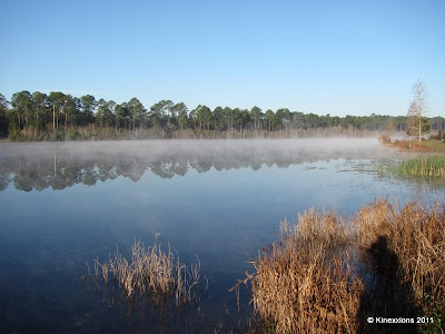
The next morning (Thursday, March 10th) I was most pleased to see the sun coming up through the trees. There was some fog but it burned off quickly. The above photo was taken through the rear window. The dark lines across the picture are from the window defroster.


By 2:30 pm I had checked into the campground at Laura S. Walker State Park just east of Waycross, Georgia. That evening and the next day I visited my niece and her daughters and delivered some things that my Mom wanted them to have. Today (March 12) was spent in just relaxing and taking it easy. I went for several walks, easing back into activity as it has been more than three months since I've done any walking let alone hiking!


I did get my wish - temperatures were in the 70s and there was lots of sunshine!The scenes below are of the lake at Laura S. Walker State Park. Photos were taken on March 12, ...


Morning fog rising off the lake.


Lilly pads.


And, of course, a Sunset...

Tuesday, January 25, 2011

Mystery Photo #9

** Update ** Color version of photos added July 29, .. to help with analysis. Also added link to fM's post, see below.

This is the eighth post (and 9th photo) in a series of unidentified photographs from the Charles Wiseman Family Bible. See this post for background information. Click on the "Mystery Photo" label at the bottom of the post to see all of the photographs in this series. As always, you can click on the pictures to enlarge them.


Paper photograph on card stock. 2 3/8 x 4 1/16. Printed on back: J. E. Walton, Photographer Vevay, Ind.

Depending upon when this picture was taken, it could be Susanna Wiseman, daughter of Charles and Naomi Bray Wiseman, who was born August 2, 1850. Susanna married James Scott on April 8, 1882. Or, it could be Elizabeth Detraz, born June 27, 1871 and daughter of Eliza Banta and Julius Detraz. Elizabeth married Charles Wiseman, Jr. on December 23, 1895. They all lived in Vevay. Or, of course, it could be someone else. . .

** Update July 29, .. **

footnoteMaven has posted Dating Old Photographs :: Becky's Mystery Photograph #9 which provides a great (tremendous, awesome) methodology for analyzing old photos. You have to check it out if you have any old pictures that have not been identified. fM also provides a list of resources/books she is using for help in creating a database for a project on Washington State and Territory photographers. A HUGE Thank You goes to fM!

A bit more informaton about the pictures, based on fM's methodology:

  • Category: Card Measurement ~ the picture is 2 5/16 x 3 11/16 and the card is 2 1/2 x 4 1/8
  • Category: Card Thickness ~ No calipers on hand ;-) but using the method suggested by fM and described here, the thickness of the card was 8 sheets of 20 bond paper or .032 inches thick, which puts it into the 1880-1900 date range.
  • Category: Color of Card ~ The front of the card is off white/light tan with a hint of yellow. The background of the image is a bit darker than the card itself. The back of the card is white, not a bright white, but definitely white.

If there is just one thing I've learned in this process it is to scan all photographs, even monochromatic, in color, to take advantage of all clues hiding within the picture. It takes more time to get a good color "match" and you have to keep in mind that every monitor will display the pictures somewhat differently, which means not everyone will see it the way you do. Now I need to find the time to go back and rescan some of these Mystery Photos and apply fM's methodology, find the resources she mentioned, and see what information I can pull from these photos, as well as that big box of unidentified pictures my Dad gave me a few years before he passed away!

Friday, January 14, 2011

SWPA ice climbing season continues (without ice)

This is by far the worst ice season I've encountered in my 15 years of South Western PA ice climbing. The 10 day forecast isn't looking so favorable either. This morning the Laurel Highlands were dusted with a little snow. Enough to motivate me to load up a full winter kit and set off for the woods in search of some new climbs. I figured if nothing else i'd get some mileage in whilst bushwhacking through the greenbriar filled jungles of Dunbar in "Fayetteville Cong".


I took a hike into a seldom climbed area named Rattlesnake Rocks. It's in the vicinity of Krahlick and Elk Rocks. Climbed mostly in the 80's by Ray Burnsworth and pals. It's a short crag that houses a fair number of climbs in the 20 to 30' range. No sport climbing here. All routes were either top roped or led trad. There are numerous moderate cracks and flake options for the aspiring trad climber. Rattlesnake Rocks got its name from the rattlesnakes that are known to frequent the area during the warmer months. I spent some time dry tooling across the base of an overhanging wall.


The left end of Rattlesnake Rocks is a great place for dry tool training


It's a great place to dry tool train with many variations and a nice flat landing. I was alone and climbed sans crampons in my mountain boots. After about an hour of bouldering and a few shots of the area I set off further across the ridge to see what I could find new. I was bushwhacking and scrambling around the hillsides. All of a sudden out of no where I stumbled into this little place.


Slabs stacked like dominos this newly discovered crag is

approximately 50' tall and has some very clean looking trad lines.

There's more crag to the right of what is visible in this photo.


The climbing looks awesome. I didn't notice any signs of previous climbers, but a few ascents may have taken place here over the years. Ed Coll, Ivan Jirak, Cal Swogar... There were a few folks that thrashed through the thickets, climbed what they could and moved on. Unfortunately many of the pioneers of the area are now deceased or have moved on leaving the history a little less than known. Either way, the routes look like a lot of fun and we're planning our first climbing visit this New Years Day. Here's a few of the plums that adorn this crag.


The first line I walked up to,

a seam system unlike many in these parts


Center section of the crag. Nice flakes and corners awaiting us


It was getting later in the day and I still had quite a hike out. I finished exploring a little and made my way to the car dreaming of the great new climbs I found. I had a great day exploring old crags and finding new. After all the time I've spent wandering the ridges and valleys of SWPA, the thing that I enjoy most is what I find next...


Not only new crags, but this is one of the things you might find in SWPA???

Sorry, no bathing beauties here!

Northern Indiana is known for it's two largest lakes, Wawasee and Tippecanoe. Then there's Big Barbee and Little Barbee too. But there are numerous small lakes in Kosciusko County. So it was that, while growing up, we spent quite a bit of time at the lakes. Aunt Jane had a cottage and later, a small trailer, at Goose Lake. We lived not far from Barbee Lakes. And the town of North Webster, where I went to school and worked, was on the west side of Lake Webster.

Apparently though, during all those lakeside visits there was no camera around (thank goodness). Even as a youngster, me in a bathing suit was not a pretty site! In all of the family picture albums I found only one of a family member in bathing suit, of my grandmother and her sister, and it was contributed to last year's edition of the COG.

When I was about 10 years old we moved to a "modern" home in a subdivision we called Whitville (because it was developed by Gene Whitacre). It was on what was then called the Armstrong road, which was the "main drag" between North Webster and the south side of Lake Tippecanoe a few miles to the west. In the summertime we'd have some fun with the "lakers" looking for the Tippey Dance Hall, which was "the" place to go on a Saturday night for young adults. We'd sit out in the front yard and invariably someone would stop and ask how to get to the Dance Hall and we'd tell them "you can't get there from here." Ah, the joys of youth. It took so little for us to be happy back then.

But I digress. One of the things that my brothers and I used to do after we moved to Whitville, was walk. Everywhere. We had to look after our little sister so we'd put her in the wagon and walk to the lake, which was about two miles away. But along the way, we would pick up pop bottles from alongside the road and put them in the wagon with my sister. The Jot-Em-Down grocery store was "sort of" on the way to the public access area of the lake and we would stop there to cash in the pop bottles. Of course, we immediately spent it on candy and pop! Then it would be off to the lake for a cool swim.

The picture below is of my brother and his son in June 1983 on the occasion of my nephew's second birthday. My brothers in-laws had a lakeside house on Chapman Lake, which is near Warsaw.


Photograph Copyright © 1983 by Rebeckah R. Wiseman

This post was written for the 74th edition of the Carnival of Genealogy :: Annual Swimsuit Edition.

Pictured Rocks National Lakeshore

Thursday, August 4th - - Unless you want to travel on back-country dirt roads, the route to Pictured Rocks National Lakeshore takes you south, then west, and then back north to County Highway 58, which follows the shoreline of Lake Superior for a few miles then takes you back inland. The drive reminded me of the route through Canada last August on the Alaska Highway – curves and hills midst a tree-lined road, with nothing in sight except more trees!


One of the first stops within the National Lakeshore is Au Sable Point where there is a very nice, but not very photogenic cascading waterfall. Too much contrast with bright sunshine and heavy shade. If I was into HDR (High Dynamic Range) Photography, this would have been a good place to experiment with it.


A short distance down the road was a place called Log Slide Overlook. A flyer picked up at the waterfall trail said of the Log Slide: “The 1,000 foot trail to the viewing platform from the picnic area is worth the walk. Newspaper accounts tell of logs sent down the dry log chute generating enough friction to cause the chute to catch fire. Today the chute is gone, but the lumberjack stories still linger as you gaze out over the Grand Sable Banks and Dunes.”


A short walk on a very well manicured path leads you to a small sand dune, about 25 feet high. This is the view from the top, overlooking Lake Superior. What you can't see is that beyond that opening is a 500 foot drop to the water's edge!


Perhaps “drop” is a bit dramatic, but a nearby sign states that the distance from the top of the dune to the lakeshore is 500 feet with 200 feet being nearly vertical. It also states that it takes only a few minutes to get to the bottom but can take an hour or more to climb back up!


The view looking to the east toward Grand Marais.


This is the view looking down toward the lakeshore, 500 feet below.


And this is the same view showing some rather energetic and youthful people near the bottom of the dunes. Provides a bit of perspective, doesn't it?


Needless to say (but I'll say it anyway), I did not even attempt this feat. I was pretty sure the old legs would give out on the way down and if they didn't the heart and lungs would get quite a workout on the way back up!


Thursday, January 13, 2011

Mammillaria Cactus


I have had this little cactus about 10 years and last month it decided to bloom. Blossoms are tiny, less than a quarter of an inch across. But such a beautiful color. There have been 18 of them in a circle around the top of the cactus. You can get an idea of size comparred to our cat, Twinkie. On looking it up I found it is in the mammillaria family.


This is another suculant plant that blooms frequently. It is almost an inch across. There are several succulants in this pot. The flower is on the plant that has long, thin but fleashy pieces not the one with the short thin tringles as it looks like, You can see the piece of plant on the left side of photo. Don't know it's name.

Tuesday, January 11, 2011

Under the Rock


This is the photo I took of the crawl space that goes all the way under the huge rock. It is next to the 'cave' in the above shot.

Thursday, January 6, 2011

SNOW... and more flood damage photos

In the newspapers, NPS officials predict road openings as late as Christmas, but cautiously hope it will happen sooner. At this time, it's difficult to tell just how long it will take to get things ready. Another complication is the ongoing Paradise construction project. The contractors had planned to work continuously this Fall and this isn't helping. In the meantime, I'm cheering for the road, electric and water treatment crews who are hustling to get things reopened.

It snowed in Longmire Friday night. It was only a few inches, but enough to ignite those enthusiastic dreams of pristine mountaineering and great backcountry runs. Paradise measured 18 inches of new snow Saturday and 21 more today, Sunday! The National Weather Service is calling for another
storm, which has already started off colder.

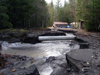
Here are a few extra images that I didn't weave into the blog earlier. To the left is the only road into the Kautz Helibase. This one may not be so easy to repair, because some of the creeks have changed their course and now flow down road corridors.

The main image above is of Longmire from the air. You can note that the river's flow has decreased, that there are a number of recently uprooted large trees and new log jams, and that the river came very close to taking out the Emergency Operations Center.

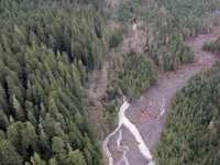
As for creeks that change their courses, the main one of concern so far is Kautz Creek. It jumped its main channel about a mile above the road, and now runs through the forest as seen in this aerial photo. Note the dry creek bed where it once flowed. You can also see the younger forest as compared to the older growth.

Monday, January 3, 2011

Gunks Routes: Sixish (5.4+)


(Photo: following the 5.3 pitch two of Sixish)


Sixish was one of my first outdoor climbing experiences. It may well have been THE first experience I had in the Gunks.


It was the summer of 2006. I was with my friend Greg, who'd introduced me to climbing in April of the same year. Greg had been climbing for a couple years. He had some leading under his belt, but not much.


I was little more than a liability to him. My experience was limited to toproping indoors with a GriGri. When we climbed outdoors, Greg had to teach me the standard commands and tutor me in ATC usage at the start of every pitch. I was just along for the ride, willing to follow Greg up anything. I was enthusiastic, but I brought nothing to the team. By agreeing to climb with me, Greg knew he was taking responsibility for both of us.


I remember nothing about the first two pitches. As I recall they went uneventfully enough.


What has stayed with me is what happened at the end of pitch two. We arrived at the GT Ledge and Greg began to scope out the 5.4 pitch three. And he wasn't at all pleased, because it looked scary. Over our heads was a gigantic roof. The guidebook said to move left to where the roof met the wall, and to climb up on the outside face of the cliff. Then we were to traverse back right just above the lip of the giant roof, and underneath a second roof, for about 15 feet to a notch, where we would head straight up to the top.


Greg thought the traverse looked precarious. It didn't appear to him that it could possibly be only 5.4. He worried that if he fell he'd hang below the roof and have trouble getting back on the rock. He was especially upset about a pointy dead tree stump, about ten feet tall, that stood on the GT Ledge just below the finishing notch. Greg envisioned taking a fall at the end of the traverse and being impaled on this stump. This was an unlikely event, but Greg can be morbid like that.


Of course, at the time, I had no tools with which to judge the likelihood of any of Greg's fears coming to pass. I just sat there impotently as he thought out loud about the risks of continuing, and about bailing. He considered leaving gear behind so we could rappel off. He worried about whether we could get down to the station atop pitch one with a single rope rappel. Unsure of this, he decided we had no choice but to continue.


Of course, I now know that we could have easily reached the next station with a single rappel. And I now know that we could have done even better: a short walk left on the GT Ledge would have taken us to the bolts above Kama Sutra, an unbelievably easy two raps to the ground. No need to leave any gear behind. But back then I was a blank slate, with nothing to offer, which turned out to be a good thing in this instance because our collective lack of information led us to continue with the climb.


Finally Greg led pitch three of Sixish; he got through it with no problems. Then I followed the pitch and it turned out to be a formative experience in my climbing life. I had no expectations, but the pitch nevertheless surprised and delighted me. No pitch in a gym was ever like this. The climbing up the face was straightforward, and then a perfect foot rail appeared just where you needed it to move back to the right above the giant roof. Traversing felt entirely different than moving upward; the most elementary of steps seemed somehow insecure when the movement was sideways. The position between the two roofs added a thrilling element of exposure. Then the exit through the notch to the top featured good holds, but the features of the real rock again seemed entirely new to me. Maneuvering my body through the notch was unlike any climbing I'd done before.


I arrived atop the cliff to find Greg totally high on having successfully done it. The lesson for him was that Dick Williams can be trusted. If Dick says the pitch is 5.4, you should have faith the holds will be there.


For me, the lessons were different. I was learning what real climbing was like. I was at a stage where I still found pulling on plastic to be novel, great fun. But doing a climb like Sixish made me see that climbing outside had so much more to offer. And I began to fall in love with the special features of the Gunks: the wandering traverses, the roofs, the escapes. The peace of sitting on the GT Ledge, comfortably belaying your partner in an atmosphere of seeming isolation among giant rocky overhangs. The pleasure of watching the birds slowly circle, of admiring the green valley below.


Fast-forward five years to . I was climbing with Margaret on a very hot day. She was looking for easy leads, and after I led Son of Easy O (5.8) in the bright sunshine, I was looking to collapse, I was so dehydrated. We took the very short walk over to Sixish, and upon finding out it was in the shade, we decided to do it.


(Photo: Placing gear at the crux of the 5.4+ pitch one of Sixish)


I was figuring I'd lead pitch one because Margaret seemed interested in taking the easiest pitches. In the case of Sixish, the easiest pitch is the middle one, which is only 5.3. I also thought it might be fun to try the 5.6 variation start to the climb. But then we looked at the traditional 5.4+ start to the climb, which ascends a large left-facing flake and then moves left into the big corner system, and it seemed pretty straightforward. Margaret said she thought she'd be fine leading it. I was sure she'd be more than fine leading it and I was thrilled to follow her.


It turned out to be a bit of a sandbag. If I'd been told this pitch was rated 5.6 I wouldn't have argued. The climbing past the initial crux flake is steep and pumpy. The holds are very good, but hanging out to deal with pro is surprisingly strenuous. Then the pitch moves left to the big corner and it gets pretty pumpy all over again. This pitch is not very long, maybe 60 feet or so, but it packs a lot of value in.


Margaret had no trouble with the climbing, of course, but she did get a bit confused about where to belay. I told her I thought I remembered that she was to go all the way around the big corner to the left and onto the main face to finish the pitch. But she found a small ledge in the big corner which seemed to match the "small belay stance" mentioned in Dick's guidebook, so she stopped there. When I arrived I thought she'd made the right choice, but then I began to lead pitch two and as soon as I moved onto the main face I reached a much better stance with some fixed gear. This was obviously the right place to do it. It wasn't an issue of safety or even really of convenience, and Margaret didn't miss any important high-quality climbing by stopping where she did. But you'll find if you lead pitch one of Sixish that you'll have a more comfy belay if you move all the way around the corner onto the main face.


I led the 5.3 pitch two, and it was such a pleasure. The pitch goes up and slightly left, passing an overhang. Then it moves right to a vertical crack system that provides plentiful holds all the way to the GT Ledge. As I led the pitch I was struck by how nice the climbing was, and how I hadn't realized what I was missing by not doing these easy classics much any more. I couldn't remember the last time I considered doing a 5.4 like Sixish. There are so many of them in the Gunks; it is so easy to take them for granted. How many climbing areas have such high-quality super-moderates like this? In most places a 5.4 would be an unpleasant thrash up a gully. But in the Gunks you get clean climbing up steep rock with great holds and pro. What more can you ask for?


(Photo: At the end of the traverse on the 5.4 pitch three of Sixish)


When we reached the GT Ledge I found the scene unchanged from 2006. The big, pointy, dead tree stump was still there. I assured Margaret she'd find the perfect foot rail up there above the roof, and she cast off on the lead. While she took care of the lead I looked at the 5.10 b/c variation, which is the original aid route directly out the huge roof. Standing on the ledge it appeared to me there'd be good pro in the crack running out the roof but later I saw Dick gives this variation a PG/R rating. I'm not sure whether he gives it this rating because of the pro through the roof, or because of poor protection for the face climbing below. It looked like it would be fun to try it out if the pro were good. I'd wager it would be easy to rig a toprope from above by climbing Sixish through the traverse and then bulding a gear anchor above the roof, but I would be a little concerned about the swing you'd take if you blew it before making much progress out the roof, or during the face climbing below the roof. You might swing out and hit a tree pretty hard.


Soon enough it was my turn to follow pitch three. The traverse was great, still exciting and exposed even after a little more experience. I was surprised by one aspect of the pitch I didn't remember: the notch at the finish is kind of hard for 5.4! Like pitch one, it is surprisingly pumpy. The holds are there but they aren't quite the jugs I was expecting, and pulling through the notch felt to me a lot like pulling a small roof. It is a fitting finish to a great three pitches of climbing, well worth doing regardless of whether 5.4 is your leading limit.

Saturday, January 1, 2011

I walk the Brampton Valley line_0001.wmv

Cycling Shorts: Care and Rotation


The process of laundering padded bicycle shorts has confused me for as long as I've worn them. Over the summer I cycled pretty much every day, which meant having to wash the one pair of shorts I owned every night (the shorts were wool, but the chamois still had to be washed). After several months of this the shorts looked like they'd been dragged through the hedge backwards, and I am sure the frequent washing and wringing caused this at least as much as the wear. The same happened in the fall/winter season with my synthetic tights. I've tried different techniques, washing by hand in the sink in the most gentle manner possible. I also try to wash just the chamois area and not the entire short, which speeds drying time and decreases wear on the rest if the fabric. Now that I have a new pair of special club-embroidered shorts, I don't want them to meet the same fate as my old ones. Is there a special soap I'm supposed to use? Is there a way to dry the shorts overnight without wringing them out?


The other day I received the packing list for CORPSCamp - my upcoming 5 day trip to Death Valley - and this list says to pack 5 pairs of cycling shorts. As in, one for each day. I was kind of shocked to see that, and suddenly felt like that kid at school who gets made fun of for wearing the same outfit every day. Are you seriously telling me that cyclists own that many shorts? What about the people I ride with who always wear their club's kit - do they own multiple pairs of identical shorts, so it just looks like they're wearing the same thing?..The logistics are mystifying.


So let me ask this straight out: Assuming you are a roadcyclist, how many pairs of bicycle shorts do you have in rotation at a time? And how do you launder them?